ជាយូរមកហើយ អ្នកស្រាវជ្រាវ និងអ្នកស្រុកមួយចំនួនយល់ថាព្រែកស្រមោចដែលជា ព្រែកជីកបុរាណមានប្រភពចាប់ពីភ្នំគូលែនចុះរហូតដល់កំពង់ឃ្លាំង ជាប់មាត់ទន្លេសាប ហើយពីមុនមកក៏ពុំទាន់មានការសិក្សាទាំងផ្នែកបុរាណវិទ្យា ផ្នែកវិស្វកម្ម ព្រមទាំងផ្នែកធារាសាស្ដ្រនៅឡើយទេ។ ប៉ុន្តែ កន្លងមកក៏ធ្លាប់មានដែរការសិក្សាពីសហគមន៍មនុស្សតាមបណ្តោយព្រែកជីក និងអត្ថបទខ្លីៗទាក់ទងផ្សេងទៀតដែរដែលបានចុះផ្សាយក្នុងបណ្តាណព័ត៌មានវប្បធម៌ខ្មែរ។
លោក ទិន ទីណា អនុប្រធាននាយកដ្ឋានស្រាវជ្រាវ បណ្តុះបណ្តាល និងផ្សព្វផ្សាយ ដែលជាប្រធានគម្រោងបានផ្តល់នូវសំណួរមួយចំនួនដូចជា តើគេជីកព្រែកដ៏ធំនេះដើម្បីទាញយកទឹកប្រើប្រាស់? បើដូច្នេះហេតុអ្វីក៏ទទឹងធំម្ល៉េះ? ដើម្បីដឹកជញ្ជូនភាជន៍ ពីកន្លែងផលិតនៅលើភ្នំគូលែន ចុះមកទន្លេសាប? ឬមួយមាន តួនាទីជាផ្លូវដឹកថ្មពីអូរថ្មដាប់ដែលជាកន្លែងដាប់ យកថ្មទៅកសាង ប្រាសាទនៅ អង្គរ? ចម្ងល់ទាំងនេះហើយដែលក្រុមស្រាវជ្រាវត្រូវធ្វើការស្វែងយល់ថា តើព្រែក ជីកបុរាណ នេះមានប្រភពពីណាទៅដល់ត្រឹមណា? មានតួនាទីអ្វីឱ្យប្រាកដ?
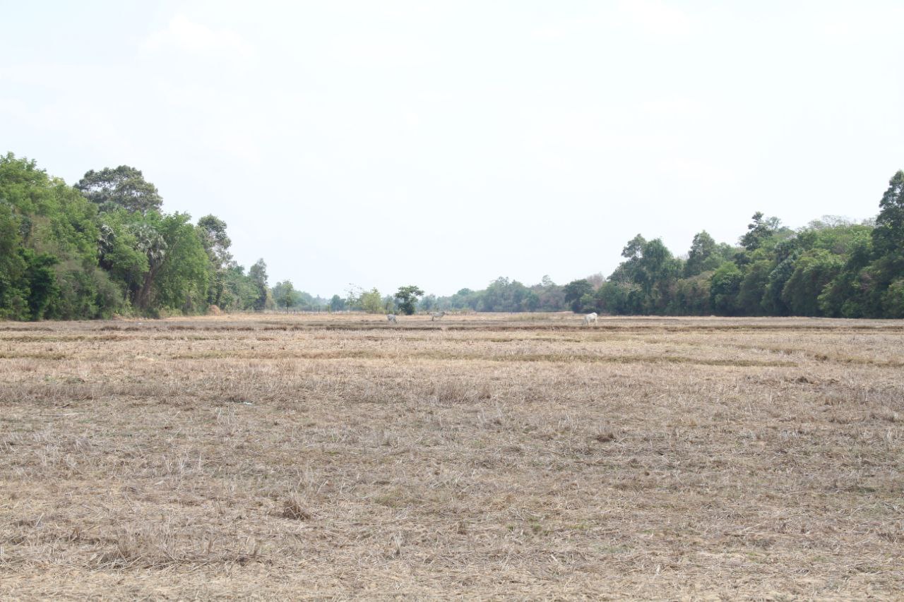
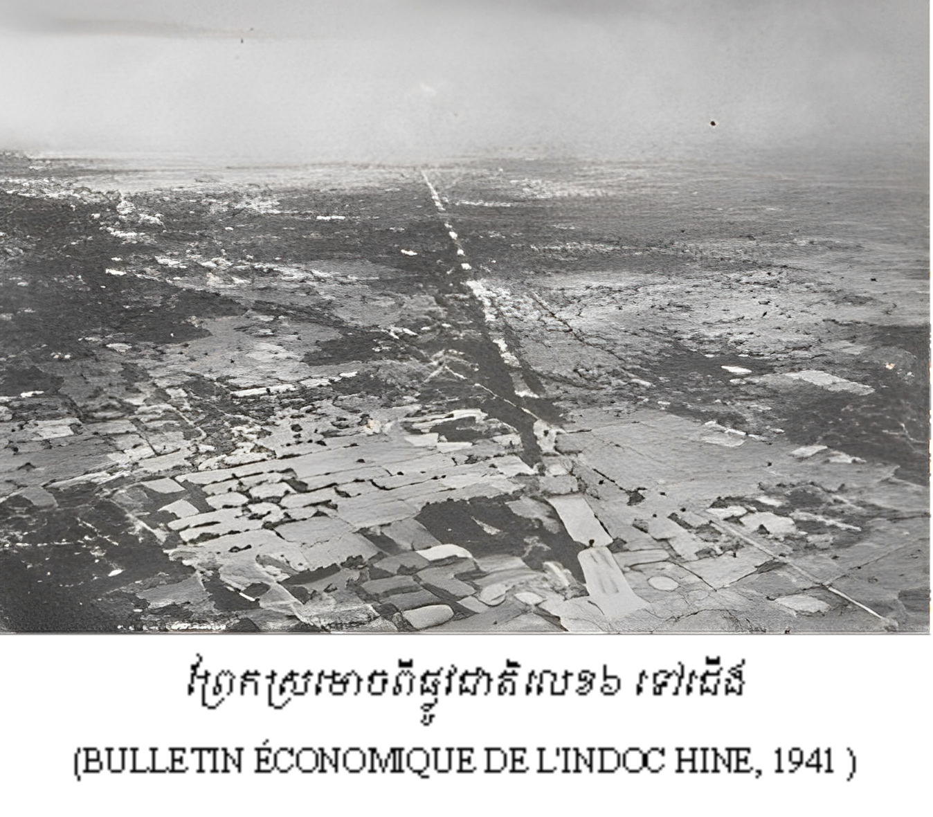
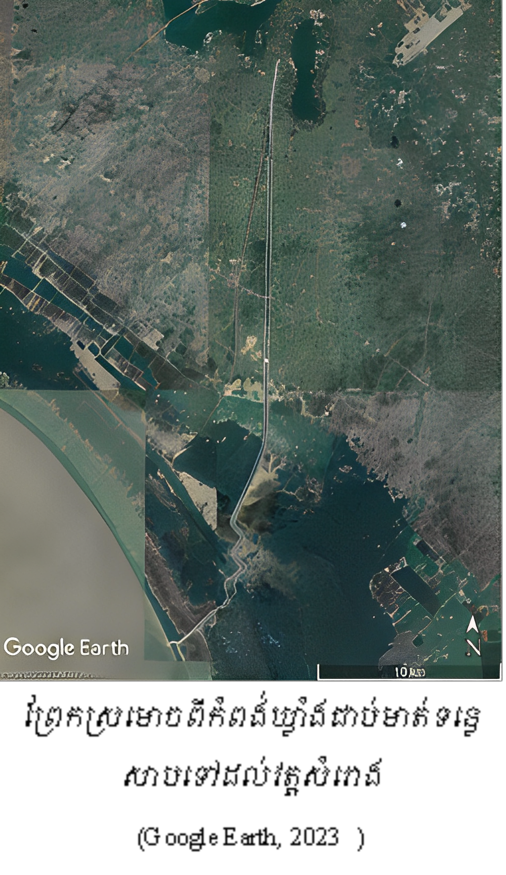
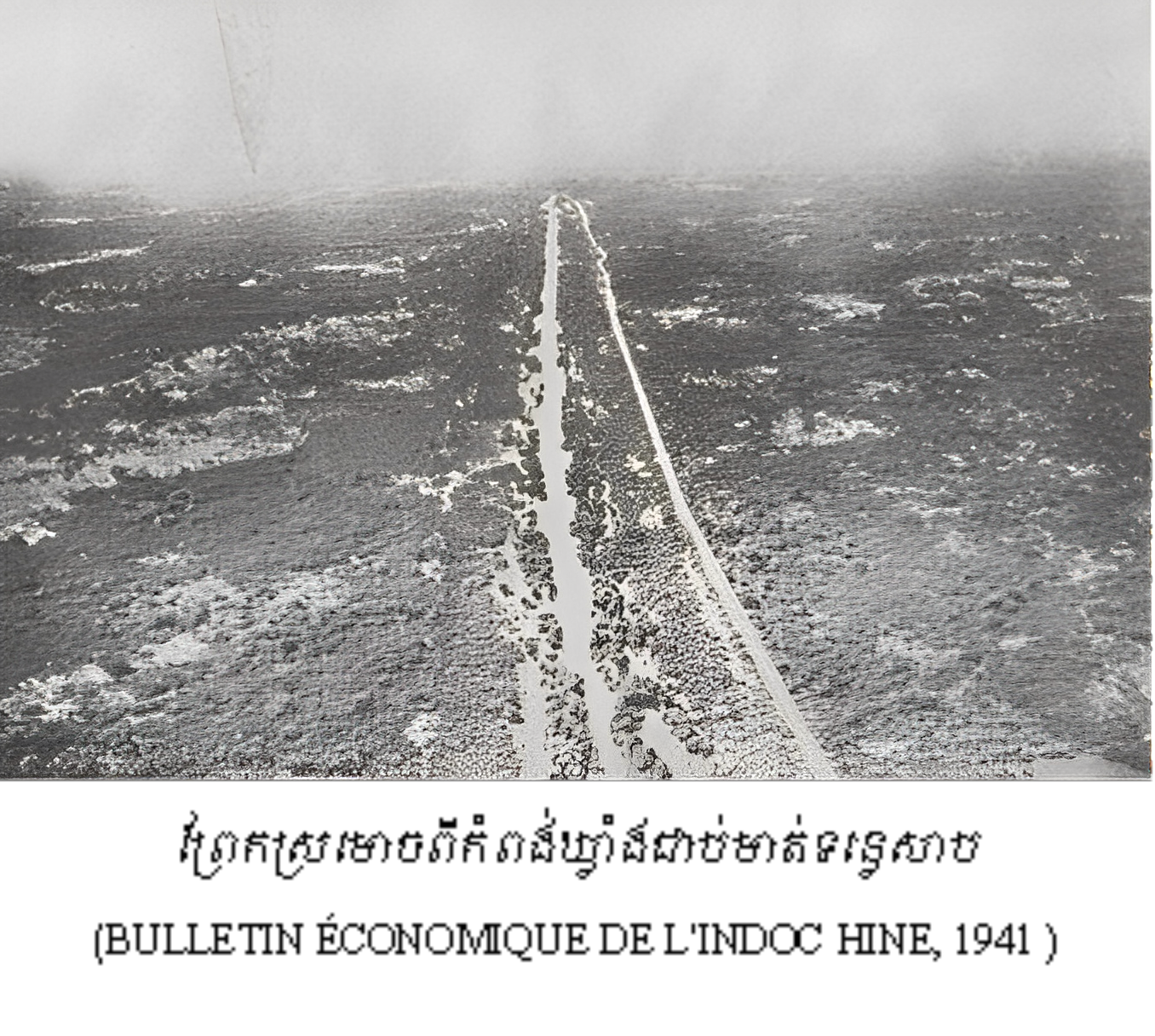
ក្រុមស្រាវជ្រាវបានប្រើប្រាស់រូបថតពីលើអាកាស ដែលបោះពុម្ពក្នុងឆ្នាំ១៩៤១ និងរូបភាពពីលើអាកាសតាមរយៈ Google Earth បានបង្ហាញថា ព្រែកស្រមោចសណ្ដូកតាមទិសខាងជើងទៅត្បូង ចេញពីភូមិសាស្រ្តឃុំកំពង់ឃ្លាំង ជាប់មាត់ទន្លេសាប កាត់តាមផ្លូវជាតិលខេ៦ ត្រង់ភូមិថ្នល់ចែក ឃុំដំដែក ឡើងទៅដល់ភូមិសំរោង ឃុំសំរោង ស្រុកសូទ្រនិគម។
ការស្រាវជ្រាវនៅដំណាក់កាលទី១ បានបង្ហាញថា ព្រែកជីកនេះលាតសន្ធឹងមិនដល់ភ្នំគូលែនទេ គឺនៅត្រឹមម្ដុំវត្តសំរោងតែប៉ុណ្ណោះ ព្រោះពុំមានស្លាកស្នាមបន្តទៀតទេ។
ព្រែកជីកនេះមានប្រវែងសរុប២៣គីឡូម៉ែត្រ កន្លែងខ្លះមានទទឹងពី៣០០ម៉ែត្រ កន្លែងខ្លះមានទទឹង១៥០ម៉ែត្រ និងមានកម្ពស់ជាង៤ម៉ែត្រ។ ក្រុមអ្នកស្រាវជ្រាវសន្និដ្ឋានថា ប្រភពទឹកហូរចូលព្រែកនេះអាចមានប្រភព២ សំខាន់ៗ៖ ទី១ ប្រភពទឹកពីភ្នំគូលែនស្ថិតនៅខាងជើងវាលរាបអង្គរ រួចហូរចូលព្រែកជីកនេះ និងទី២ ប្រហែលទឹកឡើងមកពីទន្លេសាប ច្រាលចូលក្នុងព្រែក។
យើងពុំដឹងថាព្រែកជីកដ៏ធំនេះកសាងនៅសម័យណាទេ តែគេអាចសន្និដ្ឋានថា អាចកើតមុនរាជ្យព្រះបាទជ័យវរ្ម័នទី៧ ឬប្រហែលអាចជាមុននោះយូរផង។ ក្រោយមកប្រហែលជាព្រែកជីកនេះមានដំណើរការ រអាក់រអួល និងខូចខាតដោយអន្លើ ទើបក្នុងរាជ្យព្រះបាទ ជ័យវរ្ម័នទី៧ បានធ្វើផ្លូវ មានទាំងស្ពានមួយចំនួនដែលសព្វថ្ងៃនេះក្លាយមកជាផ្លូវជាតិលេខ៦ កាត់ព្រែកជីកឲ្យដាច់ជាពីរផ្នែកនៅត្រង់ចំណុច “ថ្នល់ចែក” ម្តុំភូមិថ្នល់ចែក ឃុំដុំដែក ស្រុកសូទ្រនិគម។ អ្នកស្រុក រស់នៅតាមទំនប់ព្រែក ជីក មួយចំនួននៅ ចាំតៗគ្នាថា ព្រែកស្រមោច ឬផ្លូវសំពៅនេះជាផ្លូវទឹកបុរាណមួយដែលមានសំពៅ ចរាចរ ចុះឡើងចន្លោះ ពីទន្លេសាបទៅដល់ភ្នំគូលែន និងជាផ្លូវដឹកជញ្ជូនថ្មទៅសាងសង់ប្រាសាទ នៅអង្គរដែរ។
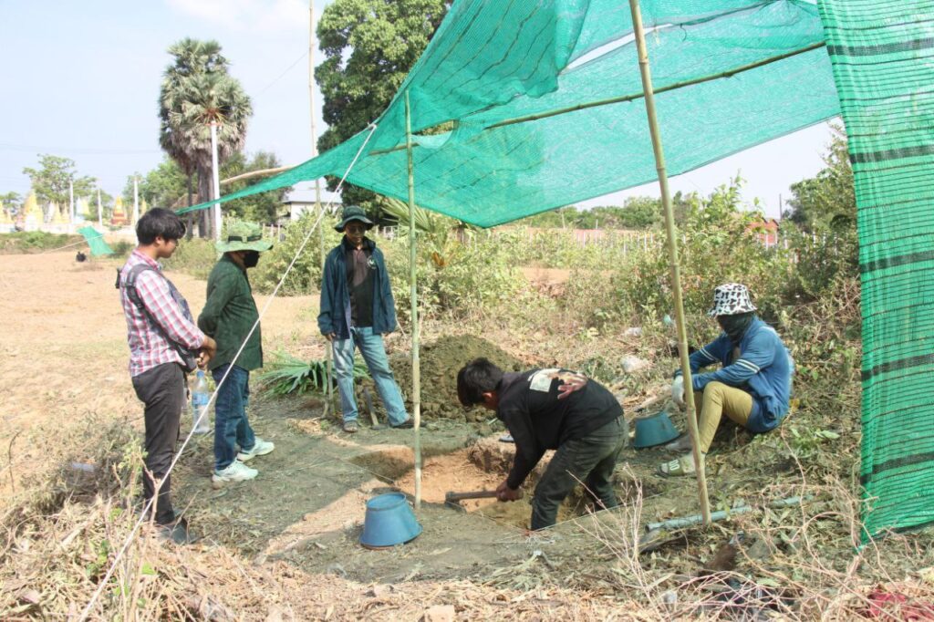
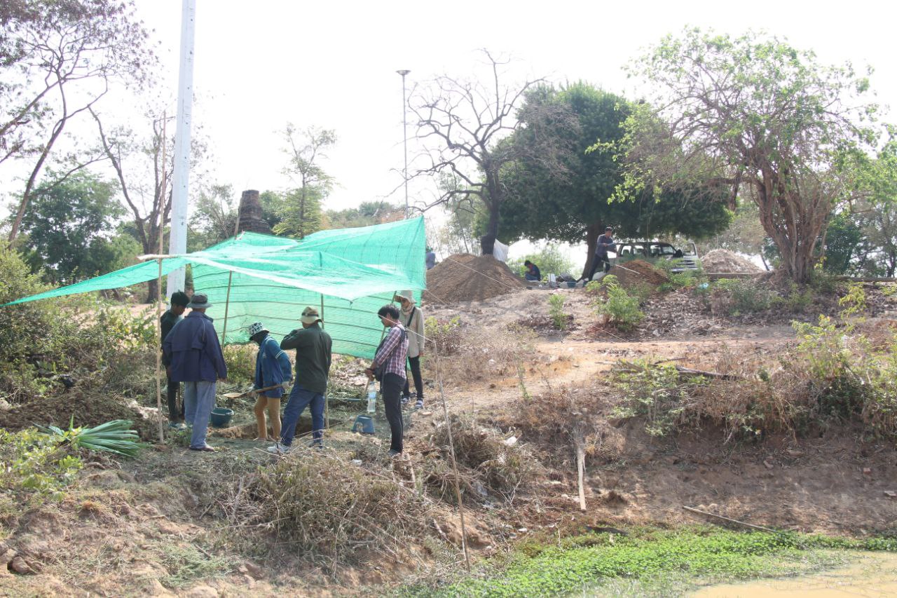
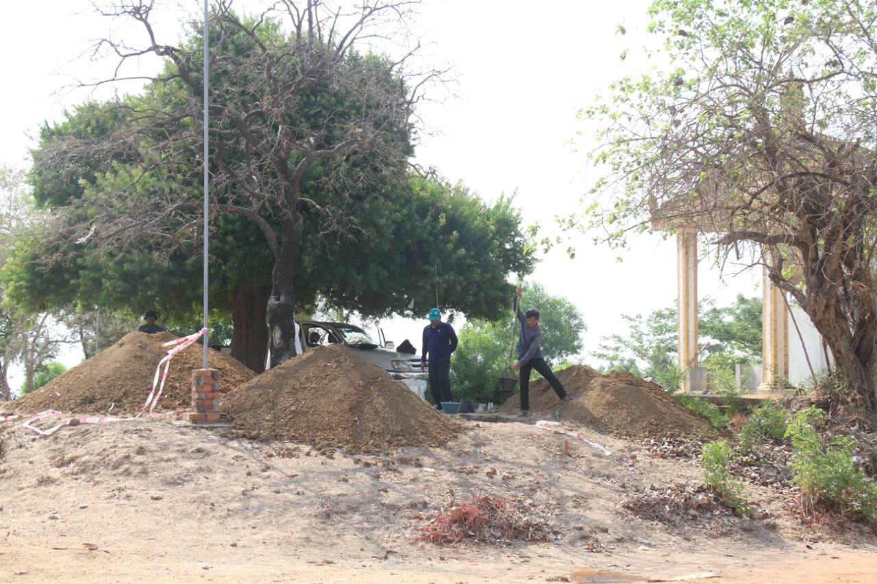
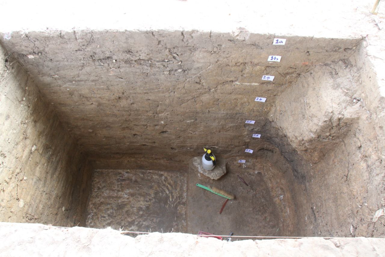
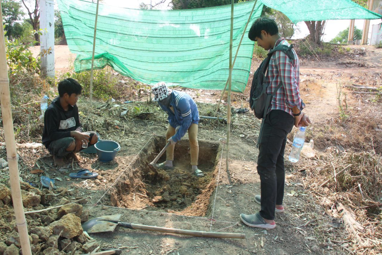
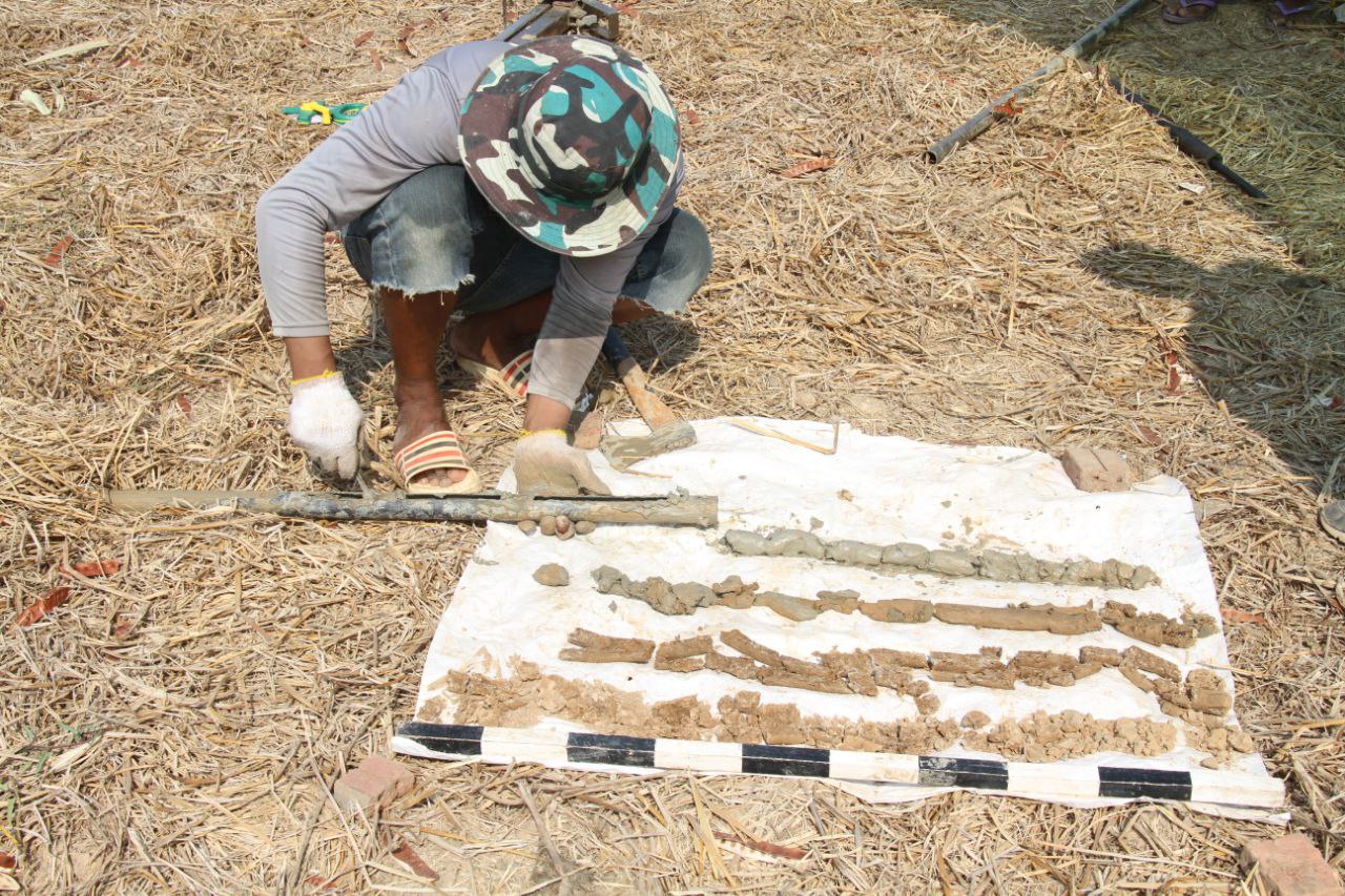
នៅក្នុងឆ្នាំ២០២៤នេះ ក្រុមស្រាវជ្រាវបានបន្តធ្វើកំណាយនៅទីតាំងភូមិថ្មី ឃុំកំពង់ឃ្លាំង ស្រុកសូទ្រនិគម ក្នុងបំណងស្វែងយល់បន្ថែម ពីព្រែកស្រមោច និងស្វែងយល់ពីការតាំងទីរបស់ប្រជាជន និងពេលវេលាដែលពួកគេរស់នៅទីនេះ។ ក្នុងពេលធ្វើកំណាយនេះ យើងបានរកឃើញឃើញ កុលាលភាជន៍ខ្លះៗដូចជាកុលាលភាជផុយ ភាជន៍មានលាបទឹកថ្នាំពណ៌ក្រហម (Red slip) ជាភាជន៍ផលិតនៅចុងសម័យមុនអង្គរ ឬដើមសម័យអង្គរ៕
អត្ថបទ៖ នាយកដ្ឋានស្រាវជ្រាវ បណ្ដុះបណ្ដាល និងផ្សព្វផ្សាយ
រូបភាព៖ ហាប់ គឹមអាន, រូបភាពឯកសារ
For a long time, some researchers and locals believed that Sramoch Canal, an ancient canal, originated from Phnom Kulen down to Kampong Khleang on the banks of the Tonle Sap River and had not previously been studied in archeology, engineering, or irrigation yet. But in the past, there have also been studies of human communities along the canal and other related short articles published in Cambodian cultural media.
Mr. Tin Tina, Deputy Director of the Department of Research, Training and Communication, the project manager, provided some questions such as: Is this huge canal being dug to draw water? If so, why is it so wide? To transport ceramics from a production site on Phnom Kulen down to the Tonle Sap? Or does it serve as a stone transport route from O’ Thmor Dap, where the Khmer ancestors took the stones to build temples in Angkor? These are the questions that the research team needs to find out where did this ancient canal come from? What is the role for sure?
Researchers used aerial photographs published in 1941 and aerial images via Google Earth to show that the Sramoch Canal, from north to south, exits the Kampong Khleang commune at the banks of the Tonle Sap River across the National Road No.6 atThnal Chek village, Dam Dek commune, up to Samrong village, Samrong commune, Sot Nikum district.
The first research phase showed that the canal did not extend to Phnom Kulen, only around Wat Samrong, because there were no further traces.
The canal is 23 kilometers long, some 300 meters wide, some 150 meters wide, and more than 4 meters high. Researchers conclude that the source of water flowing into the canal may have two main sources: first, the source of water from Phnom Kulen, located north of the Angkor’s plain area and then flows into this canal, and second, the water from the Tonle Sap.
We do not know when this large canal was built, but it can be speculated that it may have been built before the reign of King Jayavarman VII, or perhaps even earlier. Later, this canal was probably disrupted and badly damaged. Only in the reign of King Jayavarman VII did the road and some bridges, which today become National Road No. 6, cut the canal into two parts at the point. “Thnal Chek” at Thnal Chek village, Dom Dek commune, Sot Nikum district. Some Residents in that area still remember that the Sramoch Canal is an ancient waterway with ships traveling up and down between the Tonle Sap River to Phnom Kulen and a stone transport route to build temples in Angkor.
In 2024, the research team continued excavating at Thmey Village, Kampong Khleang Commune, Sot Nikum District to find out more about the Sramoch Canal, the people’s living location, and the time they lived here. During the excavation, we found some ceramics, such as fragile ceramics and polished pottery that dated to the pre-Angkorian period.
Article: Research, Training, and Outreach Department
Photos: Hap Kim An, Document Photos


